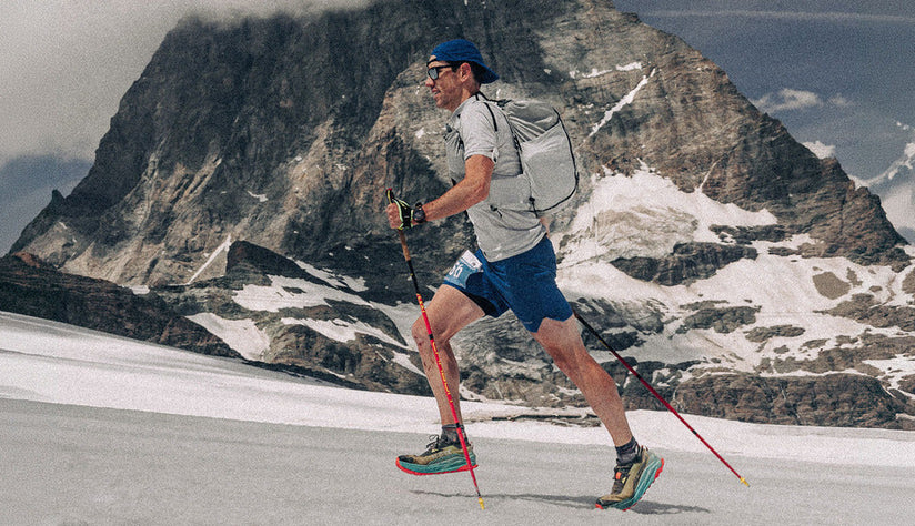
There’s something special about walking in the wilderness without coming across a single soul. Pure solidarity. Total peace. It’s the ultimate form of escapism. Feel the wind in your hair, hear the birds overhead and admire the views around you. Getting off the beaten track and enjoying one of the best hikes in the UK is easier than you think.
We’re lucky enough to live on an island with an extensive network of off-road trails, making it easy to discover the lesser-known places. So, how about swapping Snowdon for Yr Aran or Scafell Pike for its silent sibling, Scafell? There are thousands of recommended routes in OS Maps to choose from, including those less explored. If you like the thought of planning your own route, check out these guides for planning a walking route or a long-distance hike.
Time to lace up your walking boots and get ready to #GetOutside for an unforgettable hiking adventure…
Navigation
If you are going to venture into the unknown, planning a day out needs a little more thought. Firstly, there’s knowing where to go. Nobody wants to get lost in the outdoors, especially halfway up a mountain. Navigation is key to a successful walk so, before you go, make sure you have a map and you know how to use it. Many of us prefer navigating with our devices and that’s ok too. The OS Maps app has all 607 OS leisure maps available to download offline and you can find and create new routes with ease. With GPS compatible devices, like a mobile or watch, you’ll know exactly where you are on a map and see the route you want to follow, making navigating a breeze!
Like with most aspects of safety, it’s good to have a backup, especially when it comes to technology and digital devices. You can’t get more reliable than a trusty paper map and a compass. If you’re heading into the hills or exploring somewhere new, we highly recommend having a physical map and compass with you and a basic level of map reading skills. To help you brush up on your map reading skills, check out this extensive selection of free map reading guides. Whether you’re hitting the trails for the first time, you’re a seasoned pro or you have kids in tow, there’s something for every ability.

Safety
Staying safe in the outdoors is very much the same throughout the year. As well as knowing how to navigate, there are three main things to prepare:
-
Have a checklist of what you need
-
Make sure your devices are charged
-
Tell someone where you are going and when you will be back.
Unsure on which items to fill your bag with? This ultimate hiking checklist will help get you started. Along with good gear, it’s important to have good quality clothes and shoes which will keep you comfortable throughout any adventure. A three-layered system made up of a base layer, mid-layer and waterproof should be sufficient. A first aid kit should sit at the bottom of every bag and don’t forget the snacks – never underestimate the importance of fuelling. A slice of your favourite cake can often make all the difference!
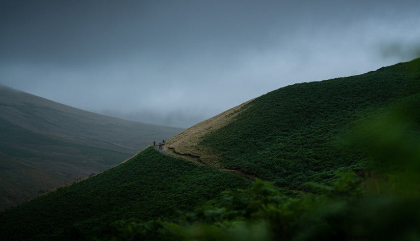
Eager to get out and explore? #TeamMontane share their best hikes in the UK, each with one key ingredient - peace and quiet along the way. From Scotland to the Lake District and beyond, these walks offer you the chance to escape for solitude and adventure...
White Mounth Munros, Scotland | Recommended by: Bee Leask | Approx: 18 miles & 1228m of ascent | Challenging | Best for: Bagging 5 munros | See route in OS Maps
A very popular route in the Cairngorms is bagging the relatively straightforward Munro of Lochnagar. Although a height of 1156m, there is a very pretty and fairly straightforward path to the summit. Now if you fancy avoiding the crowds, instead of heading back down after summiting Lochnagar, like most people do, you can do what is known as the White Mounth circuit, which takes in 4 other Munros, Càrn a’Choire Bhòidheach, Càrn an t-Sagairt Mòr, Cairn Bannoch and Broad Cairn. It’s a big day covering 29km and 1228m of elevation. But the peace and quiet from the crowds and the views are definitely worth it.
The best thing about this loop is it descends down the far side of Loch Muick and gives stunning views along the Loch and back over to Lochnagar. But the real treat of choosing this route is the views over to Glas-allt-Shiel, a lodge favoured by Queen Victoria who frequented it often and described it in journal saying “the scenery is beautiful here, so wild and grand - real, severe Highland scenery” and I couldn’t agree with her more.
If the loop of all 5 Munros is too much, you can alway head along the track on the southside of Loch Muick and aim for Broad Cairn. It’s a long walk along the Loch, but you get the views of Glas-allt-Shiel without the epic traverse. Like the sound of this? Check out my Scottish hiking gear guide to get started, or take a look at more munro hikes not to be missed in Scotland.

Monyash and Lathkill Dale Loop, Peak District, England | Recommended by: Jen Scotney | Approx: 8.6 miles & 300m ascent | Moderately Easy | Best for: Limestones Dales, wild flowers and mining history | See route in OS Maps
This loop takes in some fine examples of the limestone dales of the ‘White Peak’ half of the Peak District. In summer the valley is filled with wildflowers, including orchids and Jacob's ladder among the waterfalls and rocks high above. There is the chance to see some 18th and 19th-century mining remains and, if the water is high enough, a river appearing out of a cave.
This walk starts from Monyash. There is a small free car park at the top of Lathkill Dale (SK 1573 6645) or parking in the village of Monyash. From the village, head southwest on the Limestone Way trail. This trail runs 46 miles from Rocester in the south to Castleton in the north.
Follow the Limestone Way for just over 5km, passing the top of the lovely Ferndale and a small descent and ascent through Cales Dale. The steps out of Cales Dale are one of many steep climbs in the Peak District called Jacob’s Ladder.
When you reach the road, leave the Limestone Way and head 500m northwest down Back Lane before taking the first footpath to the left. This takes you down to the beautiful footbridge in Lathkill Dale. Turn left after the bridge and now starts 7km of one of the most beautiful dales in the White Peak. Keep the river to your left as you wind up the valley, taking in the remains of Bateman’s House and the chance to climb down a shaft into an old mine, see the river from the Lathkill Head Cave, and take on some more technical rocky sections through the limestone at the top of the valley (take care when wet as this section can be slippery). Lathkill Dale then opens up to reach the road below Monyash, turn left and continue into the village.

High Cup Nick, Murton, Cumbria, England | Recommend by: Howard Dracup | Approx 7.5 miles & 487m of ascent | Difficult | Best for: breathtaking views, particularly at sunset | See route in OS Maps
Park in the village of Murton where the route starts and ends. From the car park in Murton, follow the track up towards Murton Pike. About 1.5 miles in, you come off the track by taking a left hand fork and follow the path. Keep climbing up while following the path until you see High Cup Nick to the left of you. Head towards the centre of High Cup Nick and take in the views! There’s a light, rocky scramble down the centre of High Cup Nick, follow the path down the centre until you hit the road. At the road, take a left which will take you back to Murton and then left again which will take you back to the car park.
The views are beautiful all year round but I quite like it when it’s snowing or cold/icy and you can see the snow line. Fun fact: As part of the official Pennine Way, High Cup Nick also features on the Montane Spine Race!

Slindon Estate, West Sussex, England | Recommend by: Matt Wilkins | Approx 5.5 miles & 175m of ascent | Easy | Best for: Experiencing the history and chalk downs of the South Downs National Park | See route in OS Maps
Park in the village of Slindon, opposite Slindon College where the route starts and ends. From the parking spot, follow the footpath down towards Nore Wood Lane. Almost immediately after you reach a small bend in the road and a left-hand turn through a gate up a gravel track, head onwards and upwards to the flint stone folly built in the 18th century. Beyond the folly, follow a track into Eartham woods.
About 2 miles in, you join Stane Street, the old roman road that joins Chichester to London. Follow Stane Street for just over half a mile, whilst taking in views of the South coast. On a clear day, you’ll be able to experience views of the Isle of Wight. Head right down towards Gumber Farm, once used as a dummy airfield in World War II. Down the track, you will then approach Warren Barn; if you're lucky, timing-wise, you may be able to catch a barn owl flying around.
This walk is beautiful in spring, as a Sunday morning walk, taking in the bluebells, enjoying the peace and quiet. Deer and boxing hares can often be spotted here, too. Slindon is also home to one of the National Trust's largest woodland regeneration projects, regrowing 75 hectares of woodland!
Northern Carneddau via Drum and Foel Fras, Snowdonia, North Wales | Recommended by: Matt Cooper | Approx. 10.5 miles & 960m ascent | Difficult | Best for: Epic mountains and sea views | See route in OS Maps
The Northern Carneddau in Eryi/ Snowdonia is a short drive from my home - an area I never get sick of exploring. I love the views from the summits! The combination of mountain tops and sea views makes it feel more like the west coast of Scotland or the Fjords of Norway than a walk in North Wales.
This is a magical place to walk on a sunny day and a place that gets fewer visitors than other parts of the range, making for a more solitary experience. From the summit of Drum, you can see Puffin Island on Anglesey and the Great Orme in LLandudno. In my opinion, the best time to visit is in the cooler months of spring and autumn - you’ll find less busy roads around the villages and, in autumn, the valleys take on a stunning gold colour.
Parking is at the Forestry Commission car park at Abergwyngregyn at the start of the Aber Falls car park. Grid Ref (SH664719). Parking is free down the road by the A55 or you can park at the upper Aberfalls car park but spaces are limited and it's a narrow single-lane road.

Grey Mare’s Tail and Loch Skeen, Scottish Borders | Recommended by: Charlie Bryant | Approx. 3 miles & 278m of ascent | Moderate | Best for: seeing one of the UK’s highest waterfalls | See route in OS Maps
Begin by parking in the Grey Mare’s Tail car park, where you will see the magnificent 60m waterfall towering above you. The main path begins on the west side of the burn. Keep right and follow the path’s steep climb, parallel to the waterfall. Once you reach the top you’ll be rewarded with epic views of the Moffat Hills and the cascading water below.
Once you’ve caught your breath and taken in the incredible views, continue up the hanging valley of the Tail Burn. You will then be greeted by the striking Loch Skeen, one of the highest major hill lochs in southern Scotland. I’ve previously completed this route in autumn, but summer would be an amazing time to go and experience a dip in the loch.
The surroundings of the loch are also stunning, where you will see the peaks of Lochcraig Head, Mid Craig and the summit of White Coomb. At the edge of the loch, the well-constructed path comes to an end and, unless you intend on completing a longer, more challenging hillwalk (there is a 7.5 mile walk you can complete that includes the summit of White Coomb), you will need to return the same way you came. However, this just gives you another opportunity to take in the spectacular views of Grey Mare’s Tail!

Llanbedr Horseshoe, Black Mountains, Wales | Recommended by: Hannah Campbell | Approx: 16.5 miles, 1025m ascent | Difficult | Best for: Panoramic views of the Black Mountains and wild Welsh mountain ponies | See route in OS Maps
If you’re coming from Crickhowell, there is a big layby with enough space for 6-7 cars on the junction that turns left into Llanbedr. Significantly, there is nowhere to replenish food and water on this route so I recommend topping up your supplies in Crickhowell before you drive to the start point.
I’ve lived and breathed the Black Mountains for almost 15 years now and, time and time again, I am blown away by just how quiet these hills are. Tourists often opt for the more populated trails of the Central Beacons, missing out on, what I believe to be, one of Wales’s most effortlessly beautiful hills. The walk starts with a long sharp incline up to Pen Cerrig Calch – but don’t be put off. After this steep pull up, the walk eases off a bit, opting more for gradual and far shorter undulations rather than long, steep inclines.
The horseshoe loop takes in some of the most iconic peaks in the Black Mountains and finishes back down in Llanbedr where you can enjoy a drink by the fire in the Red Lion (or back down in Crickhowell if you have dogs!). Do be warned – there isn’t much shelter or places you can easily bail out on this route. Ensure you take a full set of waterproofs to protect yourself if the weather changes.

Glenridding Dodd and Sheffield Pike, Lake District, Cumbria | Recommended by: Steph Robinson | Approx: 4.8 miles & 602m ascent | Moderately Challenging | Best for: The perfect spot to catch a sunrise | See route in OS Maps
A small hike with BIG views! Starting in Glenridding car park beside the village shops, follow Greenside Road which will lead you past the Travellers Rest Inn. Bear right and then bear left, once you've passed the cattle grid and reached Rake cottages, it’s time to turn right onto the rocky footpath and head up The Rake to the top of Glenridding Dodd.
Enjoy the beautiful views of Glenridding village as the short but steep ascent begins, leading up to the col between Glenridding Dodd and Sheffield Pike where you will reach a gate in a cross wall. Bear right and follow the wall line path for a short while, continuing up to the cairn on the summit of Glenridding Dodd. You'll be rewarded by fantastic views of Ullswater and the surrounding peaks including the very tops of Helvellyn range.
Finish the walk by heading back down the same way, or you have the option to extend the walk up to Sheffield Pike to 'bag' a second Wainwright. Continue over Sheffield Pike and bear left and follow the footpath where you’ll start to descend via the zigzag path into the valley. Continue past the Youth Hostel. Bear right onto the track signposted & Red Tarn and Helvellyn you will then bear left onto the gated wooden footpath where you will continue onto the path along the hillside until you reach your finish point!

Whiteheugh Loop, Northumberland, England | Recommended by: Franco Cookson | Approx: 11.5 miles & 377m ascent | Difficult | Best for: Border Reiver history, difficult moor terrain, woodland tracks | See route in OS Maps
For those who really want to 'get off the beaten track' whilst still just about staying within the borders of England, you can't beat the remote forests of Kielder, nestled peacefully just to the south of Scotland. One of the quietest corners of Kielder Forest are the moors and woods above the hamlet of Greenhaugh. Unless you bump into the shepherd or gamekeeper from the nearby Emblehope, you're almost guaranteed solitude, as well as a good amount of high-kneed moor-bashing.
This loop takes in both the forgotten crag of Whiteheugh, as well as the historically significant Black Middens Bastle - a well-preserved example of the fortified farmhouse typical of this area in the late medieval. The general ambience of this part of the world is one of exposure. For a large part of this walk you get a sense of being inexplicably high up. There is something about the remoteness and exposure of these rusted sweeps that gives a sense of altitude, with a kind of 'roof of Northumberland' feel to the place.
The walk begins at Black Middens Bastle car park and takes a forest track past one of the most tucked away wedding venues in England (at Comb). A long plod up the forest track, past Whiteheugh Crag eventually leads to a difficult crossing of the exposed Emblehope Moor, before once again seeking refuge in the trees of Kielder, along the border county ride, which is followed southwards through the tranquil trees of black burn. A large part of the route is through managed woodland, but a sense of the history and beauty of this landscape is still ever-present.

Looking for more hiking inspiration?
If our team's recommendations have got you nicely inspired to take on a hike, make sure you are properly kitted out with our lightweight, breathable hiking gear for men and women so you can take on the UK’s notoriously changeable elements with confidence.
For those seeking more hiking inspiration in the UK, take a look at the Skye Trail or Bee Leask's guide to bagging Munros. You can also brush up on your map reading skills with the help of this handy blog.